After a frustrating few weeks that saw 3 consecutive rainy Saturdays force me to cancel plans, Saturday the 22nd was a cracker, a perfect August day with little wind and blue skies.
The day saw me tagging along with the Christchurch Tramping Club's trip to Staces Tarn, set in the hills above Lake Heron. While the tarn was the main destination, the option was also there to continue on to the summit of Staces Hill further along the ridge if time allowed.
A group of 15 trampers arrived at the carpark at the entrance of the Cameron Valley, with the first obstacle being a crossing of the Cameron River just 5 minutes into the trip. Most of the group decided to cross in shoes or sandals, thus keeping their boots dry for the day ahead. I was not in this majority, comfortable to wade on through in my boots as it takes a fairly substantial crossing to get them totally soaked.
The first braid of the Cameron came and went without too much fuss, but it was immediately evident that fording the main braid, which currently runs hard against the true left bank at our crossing point, was going to be a wet exercise. There was nothing else to do except take the plunge, so in we went for a knee deep crossing. It was a simple ford, albeit very cold, and we gathered ourselves atop a small knoll a few metres above the river to set off up towards the tarn.
It was here that, unbeknown to most of us, a small drama was unfolding on the slope just below us. One of the party was having quite a time of it scrambling up the bank onto the knoll, finally emerging with assistance, covered in mud.
After re-grouping, and donning boots, we set off up the hill. Initially it was a short, steep climb up a tussock face to gain the open ridge that would lead us along to the tarn. Even at this early stage the group was well spread, and it was apparent that some were going to find the day much harder going than others, so a quick decision was made to split into 2 groups, one that would include those keen to get to the summit of Staces Hill, while the other, slower group would pace themselves and endeavour to reach the tarn.
We set off at a steady pace, the ridge providing pleasant travel along its' undulating line. As we gained height the views became ever more expansive, a hint of what would follow higher up. Partway along the ridge we encountered what was identified as a falcon, nestled down in the grasses, which provided a small distraction.
We paused as lunch time neared, knowing we were quite close to reaching the tarn, but also knowing that lunch would be welcome. Maps were produced, and it was determined that the tarn should lie just in behind the next bump on the ridge, so we pressed on, eager to sit tarn-side and enjoy the scenery over lunch.
On this occasion the map reading proved accurate, and as we rounded the high point on the ridge the tarn came into view. Closer inspection revealed it to be frozen over, not surprising given that it sits at around 1215m altitude.
A pleasant lunch stop was taken at the tarn, with a couple of brave folk venturing out onto the frozen surface, before we set off on our summit bid. Travelling light, having left packs at the tarn, we made good time up the easy angled ridge that leads onto Staces Hill. The snowline was reached at around 1300m but it wasn't deep, allowing us to make the summit comfortably, reaching the top in around 45 minutes from the tarn. Standing at 1479m, Staces Hill is a modest summit, but is set back nicely from the surrounding ranges, meaning it's well placed to take in the stunning surrounds.
The extra energy expended to reach the summit was well worth it, with spectacular views in all directions. Moving clockwise around the compass, we could see down Lake Stream to the Rakaia, across to the Palmer Range, with Smite and Godley Peaks standing out, then round to Mt Catherine and on to the Taylor Range, capped by Mt Taylor itself, at 2333m the highest of all the Canterbury foothills. From there the eye roved over the Lake Heron basin, before swinging round to the Wild Mans Brother Range alongside the Cameron Valley, with the Big Hill Range in behind it.
The most spectacular views however lay to the northwest - the magnificent Arrowsmith Range at the head of the Cameron Valley. Its' jagged ridgelines made for a striking spectacle from our humble vantage point, with the entire range on display, decked out in its' winter coat. The sight had many of us planning a trip up to Cameron Hut, which sits at the base of the range and boasts intimate views of this stunning wedge of mountainous country.
With photos taken, and the scene savoured, our time on the summit was done. It was now mid-afternoon and a hasty retreat back to the cars was all that remained of the day - that and a further crossing of the Cameron River.
As we descended off Staces Hill and neared the tarn we spied the slower group - it appeared that they had all made it to the tarn, a worthy achievement given the events at the start of the trip. On seeing us they made their departure, knowing we would catch them lower down, which we duly did not too far from the cars. There was just that one last obstacle - the Cameron River.
The glorious nature of the day had evidently caused a reasonable amount of snowmelt in the upper valley, as the ford of the Cameron was now a much more challenging proposition.
First to the river, and confident in our abilities, Brian and I went straight across, discovering the water to now be thigh deep on me (I'm 6-foot), and icy cold. We then watched as others linked up and made their way across, some perhaps forgetting some river crossing basics and trying to cross angling up into the current instead of working across and slightly down stream, therefore not fighting the flow of water. It came to the last few, and a few concerns were aired about their ability to safely cross, so a couple of us went back across to assist.
Several crossings later (I made 5 in all), we were all safely across, and made the easy amble across the riverbed back to the cars.
Another superb day in the mountains. Thanks to the CTC for accommodating me, and to Janey and Roger for the invite and the ride.
 |
| Preparing to leave the carpark at the entrance to the Cameron Valley |
 |
| Cameron River, with Sugarloaf and Mt Catherine in the background |
 |
| Contemplating crossing the Cameron |
 |
| On the knoll above the Cameron, looking towards Lake Heron and the Taylor Range |
 |
| On the knoll above the Cameron, looking towards Mt Catherine (2085m, left of centre) and Sugarloaf (1238m) |
 |
| Climbing to the ridge, with the Cameron River well below us now |
 |
| Steepest part of the climb |
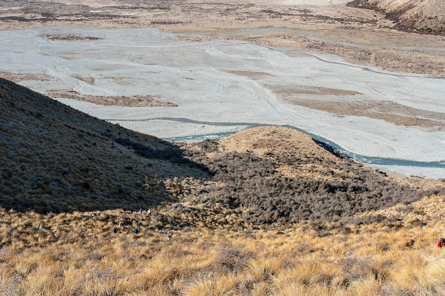 |
| The group spread far and wide early in the tramp |
 |
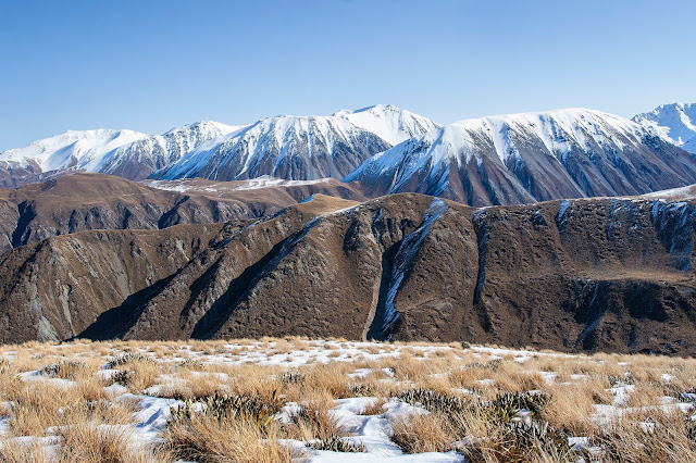
| Looking down the steep face we climbed to gain the ridge, with Lake Heron and Mt Taylor (2333m) providing the backdrop |
 |
| Brian waiting for the rest of the group to make their way up |
 |
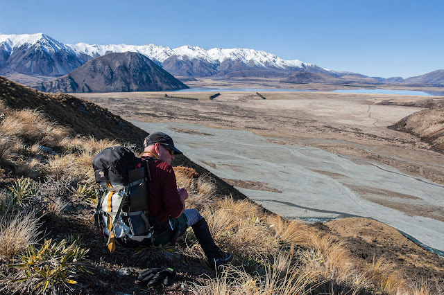
| Looking up the Cameron Valley, with snow-capped peaks spurring us on. Wild Mans Hill (1856m) is centre image |
 |
| The lower tarn (marked on the map west of Pt 910m) and Pyramid (1598m), viewed from the ridge leading to Staces tarn |
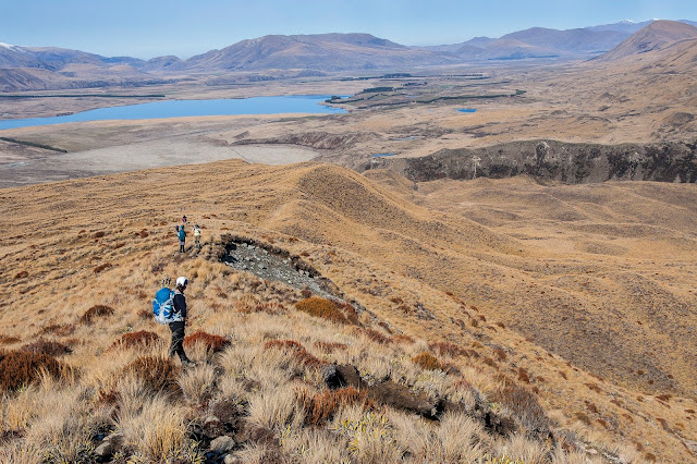 |
| Looking down the bumpy ridge, back towards Lake Heron |
 |
| Arriving at the tarn below Staces Hill |
 |
| Staces tarn, with Staces Hill (1479m) along the ridge ahead beyond the tussock top on the left |
 |
| The group arriving at the tarn |
 |
| Time for lunch |
 |
| Mani (spelling?) braving the frozen surface |
 |
| Pyramid rising behind the tarn |
 |
| Starting the climb up to Staces Hill |
 |
| Arrowsmith Range slowly coming into view as we gain height |
 |
| Reaching the snowline, Mt Arrowsmith (2781m) on the left |
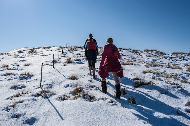 |
| A few false summits along the way |
 |
Arrowsmith Range in all its' splendour
|
 |
| Peaks of the Arrowsmith Range - I haven't marked East Horn (directly in front of Mt Arrowsmith) or Tent Peak (directly in front of the Tower-Upham-Jagged cluster) |
 |
| View north from Staces Hill - Middle Hill (right foreground), unnamed peaks SW of Teddys Hill in behind, and Tower/Upham/Jagged Peaks and The Marquee (rear left) |
 |
| Wild Mans Hill (right), and the Big Hill Range at rear |
 |
| Enjoying the views from the summit of Staces Hill |
 |
| Enjoying the views from the summit of Staces Hill |
 |
| Roger on Staces Hill, with the Big Hill Range behind |
 |
| Looking to the Palmer Range - Smite Peak (2003m) just left of centre, and Lagoon Peak (1988m) just right of centre. Ribbonwood Stream is seen draining away to the right of image, Nell Stream centre image, and Smite River far right |
 |
| On our descent - Brian stopping to take in the views of Lake Heron and the Taylor Range |
 |
| Pyramid (left), Big Hill Range (centre, rear), and Wild Mans Hill rising out of frame to the right |
 |
| Fun on the snow slopes descending off Staces Hill |
 |
| Descending back to the tarn |
 |
| Enjoying the sun before making the descent to the Cameron River |
 |
| Preparing to make our final, steep descent back to the Cameron River |
 |
| Follow the leader down the spur |
 |
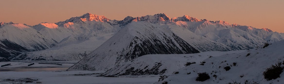
| Departing Lake Heron as gorgeous evening light hits the Taylor Range - Mt Taylor (2333m) almost dead centre |
 |
| Crown Copyright - Land Information NZ |
Access: Head to Mt Somers village, then take Ashburton Gorge Rd to the Hakatere junction. Turn north and drive up to, and around Lake Heron following the road until you reach a gravel pit (marked on the map). From here, a vehicle track heads off to the left to the entrance of the Cameron Valley.
Time: Carpark to tarn 2hr 15mins, tarn to Staces Hill 45mins, return 2hrs
Map: BW19 Taylors Camp, BX19 Hakatere
Hut: None


No comments:
Post a Comment