A little jaunt up Peak Hill was originally planned to be our way of easing ourselves back into tramping after a few months of not having done anything - a warm up for the weekend trip to Youngman Stream Hut. As it played out, the trips were done the other way around, due to the necessary child-minding arrangements falling that way. So we found ourselves heading off to Peak Hill with the weekend trip already under our belts, but still looking forward to an enjoyable day out in the Canterbury high country.
Peak Hill sits at the edge of Lake Coleridge, wedged between the lake and the Rakaia River. Standing at 1240m, Peak Hill is not a big climb, but its' isolation from other peaks in the area means that grand views in all directions await those who venture to the summit.
We started off with a short walk across a farm paddock. The marker poles lead along the fence line, and the right to cross this section comes with the mandate that trampers stick to the marked route, so don't cut directly across the paddock. Once across the stile at the head of the paddock, we started the climb. The route took a direct line straight up a narrow spur that runs up to the ridge line, following poles. Scrub grows densely in the gullies either side of the spur, so best to stay on route.
After 45 minutes of steady climbing we gained the crest of the ridge. From here, poles lead up along the ridge to the summit. It's straight forward, just follow the poles. As we gained height the wind strengthened, bitterly cold coming off fresh snow, so we donned jackets and were immediately more comfortable.
We made our way over Pt 1043m, a small, rocky knob on the ridge. Here the ridge, which is generally broad, narrows but is easily traversed. After dropping down through a small saddle we made the final climb to the summit of Peak Hill, reaching the top in 2 hours.
The view from the summit was spectacular, with an unimpeded outlook over the landscape around us. Looking around, the eye roved over the Hutt, Black, and Palmer Ranges towards the upper reaches of the mighty Rakaia valley. Double Hill appeared a mere pimple on the grand vista, beyond it stretched the Mathias River. Continuing round the compass, Mt Algidus and the Wilberforce River came into view, then gave way to the peaks around Lake Coleridge and the high country stations at their feet. Words don't give the scene adequate justice - I recommend you see it for yourself.
The wind was brisk on the summit so we didn't linger, instead opting to descend to a sheltered spot lower down the final section of ridge to eat lunch. As we ate we noticed cloud building on the other side of Redcliff Saddle so we made a hasty retreat. We watched it creep closer as we made our descent, reaching the car with around 10 minutes to spare before the rain reached us - a reminder of how quickly things can change in the mountains.
 |
| At the base of the climb up Peak Hill, looking towards Steepface Hill |
 |
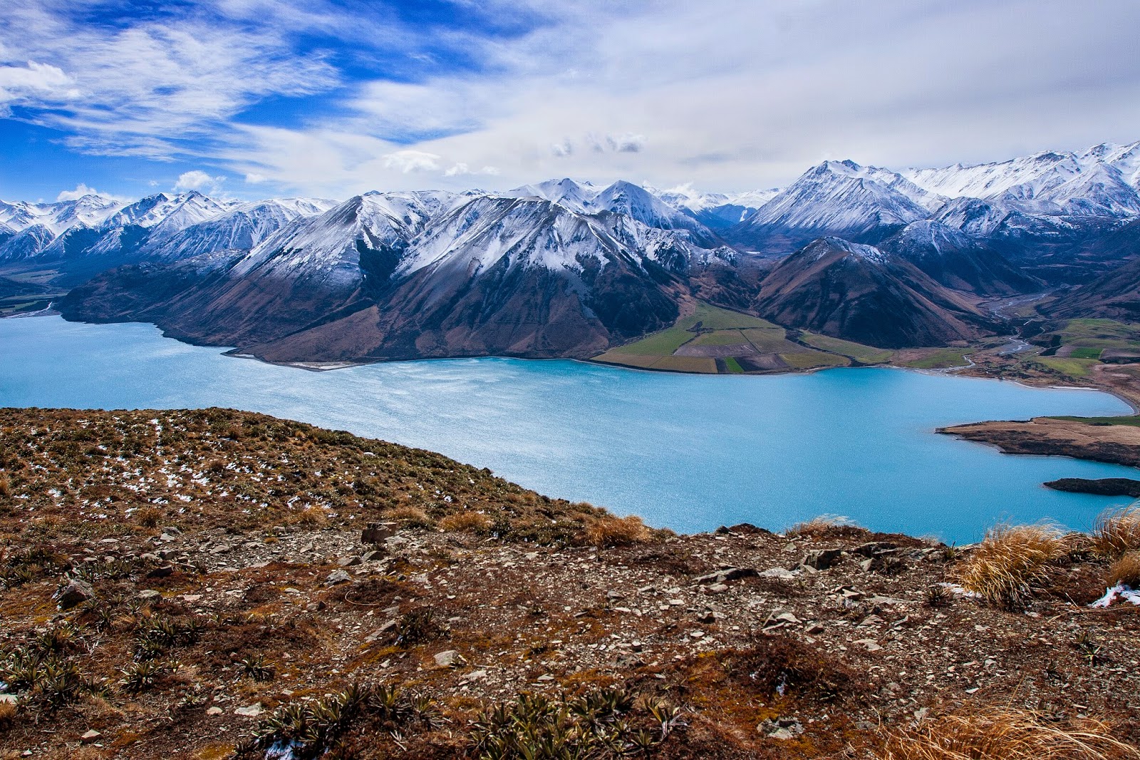
| Southern end of Lake Coleridge, from the lower slopes of Peak Hill |
 |
| On the ridge, starting towards Pt 1043m |
 |
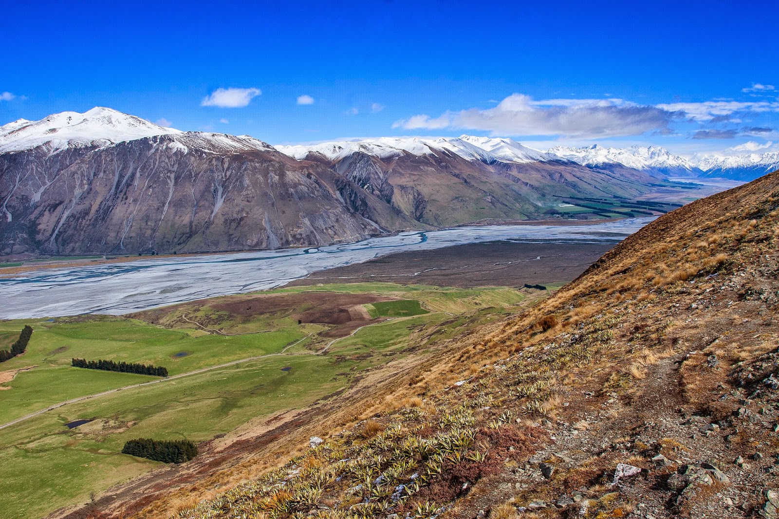
| View across the Rakaia to Steepface Hill (left), Redcliff Saddle, and Black Hill (right) |
 |
| Approaching Pt 1043m, with Peak Hill (1240m) in sight |
 |
| On the rocky, narrower section of ridge passing over Pt 1043m |
 |
| Julia on the narrower section of ridge, with Peak Hill ahead |
 |
| Looking across the Rakaia to Black Hill (2067m, left) and the Palmer Range |
 |
| Coleridge Pass (centre), with Torlesse Range through the pass, Blue Hill to the left & Red Hill to the right of the pass |
 |
| Looking back down the ridge from the base of the summit ridge of Peak Hill |
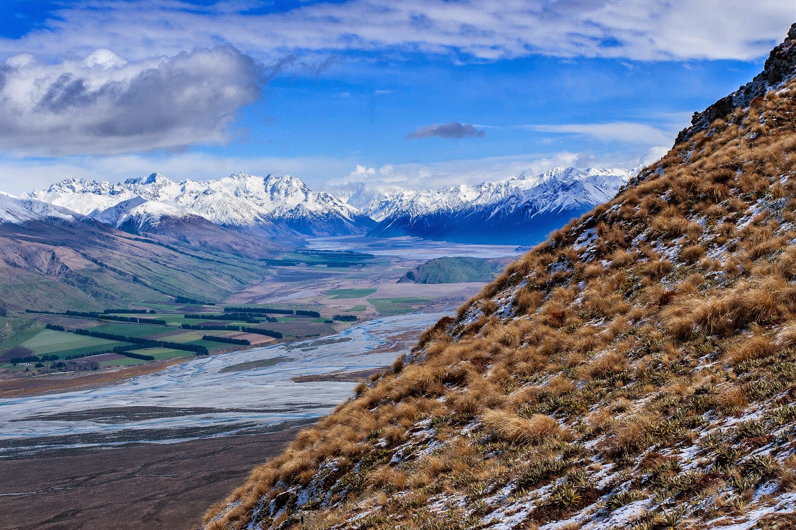 |
| View into the Rakaia headwaters, from the summit ridge of Peak Hill |
 |
| Ryton Station, with Mt Enys, Blue Hill, and the southern Craigieburn Range behind |
 |
| Reaching the summit of Peak Hill |
 |
| From the summit of Peak Hill, looking up the Rakaia valley |
 |
| Northern end of Lake Coleridge and the Wilberforce River beyond |
 |
| Lake Coleridge, with Cottons Sheep Range (front), Birdwood Range (back left), Mt Olympus & Craigieburn Range (back right) |
 |
| Julia on the summit, with Steepface Hill and Redcliff Saddle behind |
 |
| View down the Rakaia, from the summit of Peak Hill |
 |
| Looking across Lake Coleridge to Kaka Hill (lakeside), Red Hill (left), and Big Ben Range (centre background) |
 |
| L to R: Steepface Hill, Redcliff Saddle, Shingle Hill (rear), and Black Hill (rising out of frame) |
 |
| Black Hill (left), and the Palmer Range. The manicured farmland to the right is Glenrock Station |
 |
On the summit of Peak Hill
|
 |
Panorama from Peak Hill, covering around 180deg from Redcliff Saddle round to Carriage Drive
|
 |
| Tighter pano, focussing on the Rakaia valley |
 |
| Descending off Peak Hill, looking for a sheltered spot for lunch |
 |
| Descending off Peak Hill |
 |
| L to R: Steepface Hill, Redcliff Saddle, Shingle Hill (rear), and Black Hill, and the storm brewing |
 |
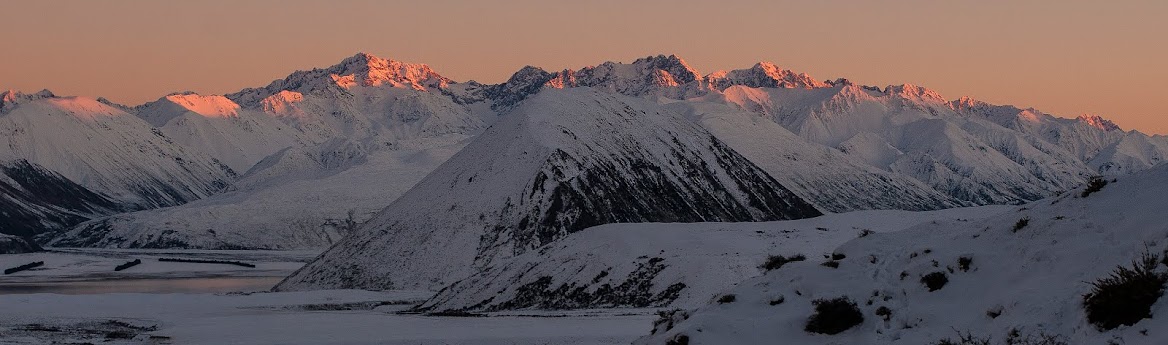
| Peaks north and east of Lake Coleridge, from the Wilberforce round to the Big Ben Range |
 |
| Mt Enys, Blue Hill, Coleridge Pass, and Red Hill, taken from near Pt 1043m |
 |
| Storm building through Redcliff Saddle |
 |
| Great day to be out in the hills |
 |
| On the ridge near Pt 1043m |
 |
| The rain reaches Redcliff Saddle - will we make it to the car in time? |
 |
| Rain spilling over Steepface Hill, and our car is in sight |
 |
| On the lower slopes of Peak Hill, just in time |
 |
| Crown Copyright - Land Information NZ |
Access: Take SH72 towards the Rakaia Gorge and follow road signs to Lake Coleridge and Algidus Rd. Peak Hill is signposted along the way, and there is a DOC signpost at the carpark area. Keep to the marked route, all surrounding areas are private land.
Time: 2hrs to the summit
Map: BW20 Lake Coleridge
Hut: None
No comments:
Post a Comment