"You will go out in joy and be led forth in peace; the mountains and hills will burst into song before you" - Isaiah 55:12

15 December 2014

Comyns Hut (attempt) - 6 December 2014

It had been quite a while between tramps, so I was rather looking forward to this weekend away. With the fickle spring/early summer weather proving yet again to be difficult to predict, we ran through several options before settling on Comyns Hut as our destination.
Nestled in the block of country between the Rakaia River and Lake Heron, it offered reasonable prospects of decent weather as it sits well east of the Main Divide, which was expecting a barrage of rain from the northwest.

The proposed route would take us over Turtons Saddle and down to Comyns Hut, a 4-5 hour journey into the heart of mustering country.
Unfortunately we only got a short distance before one of our party became very unwell. Despite valiant efforts it became clear we couldn't go any further so, after a rest to recharge, we turned and made the short trek back to the car.

A sad end to a promising weekend, but one that at least gave us a glimpse of country we'd like to return to see more of, with a number of good old mustering huts scattered throughout the area.


Looking up the Rakaia River from the start of the tramp

View across the Rakaia up the Wilberforce River, flanked by Mts Algidus (left) and Oakden

Rolleston Range

Early in the tramp, the first section passes through still-used farmland

The views opening up as we gain height

The end of the road for us on this trip, and the remarkable rock mid-valley

Pleasant travel through open farmland

Rolleston Range

Returning to the car, Mt Oakden (1633m) ahead

Looking up Glenrock Stream, and a view of the rock outcrop

Cloud building along the Main Divide
Almost back at the car (behind the trees ahead) - wonderful country


Proposed route to Comyns Hut
Crown Copyright - Land Information NZ


Access: Follow SH77 through the Rakaia Gorge, then around 3km west of the gorge turn right onto Blackford Rd. Follow this road (which becomes Double Hill Run Rd for35km to the marked easement at Glenrock Stream.

Time: Road to Comyns Hut 4-5hrs

Map: BW19 Taylors Camp, BW20 Lake Coleridge, BX19 Hakatere

Huts: A Frame Hut (3 bunks), Comyns Hut (8 bunks)

2 November 2014

Pinchgut Hut - 26-27 October 2014

After a successful trip up Mt Richardson earlier in the year, a test run to see if Toby was up to overnight tramping yet, we arranged for an easy trip to Pinchgut Hut, located in the North Canterbury foothills on the northern side of Mt Thomas.

The tramp began with a crossing of the Okuku River, an easy proposition for us adults, but a daunting one for 9 year old Toby. After a few moments of preparation, we linked up and entered the gently flowing water. As expected it was an easy crossing, and it was pleasing to see Toby's look of achievement once safely on the other side.
From here we set off along the track. The old sign at the start of the track indicates it's 4-6 hours to Pinchgut Hut - this is most definitely wrong, and even the times posted on DOC's website (3-5hrs) are generous to say the least.
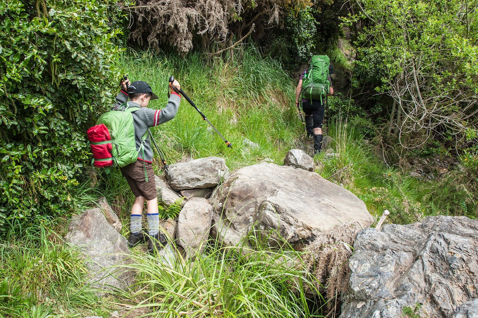
Initially we followed farm tracks for a short distance before emerging back at the river. From here the track narrowed but is benched and so makes for comfortable tramping. It is however what I would describe as being a true tramping track, rough in places and requiring some attention on the part of the tramper, certainly not one of the well manicured highways that can be found on more popular tramps around the country.
The track kept to the true right of the Okuku River, staying close to the river, and after about 2 hours dropped back down to the riverbed immediately before Whare Stream. Our progress had been a little slow, with Toby finding his feet on a rougher track than he had previously encountered, and average adult parties would probably reach here in 90 minutes or so.
After a short section of boulder hopping to regain the track we began the only climb of the day. I was pleasantly surprised we were this far on already, knowing that the hut was just a short climb then a sidle round a spur away. We climbed steeply at first, then began the sidle round to the hut. The line of the track differs slightly than that marked on Topo50 BW23, and I've endeavoured to indicate the current line as best I can on the map with this post.
The climb was straight forward but in the afternoon sun was quite hot, particularly once we had sidled round the spur onto north facing slopes. Knowing it wasn't too far though spurred everyone on, and when we reached the sign marking a track junction I knew the hut was just round the corner - literally as it turned out!

We arrived to find 2 other parties already there, a group of 4 from Christchurch, and a couple from Rangiora, meaning that our arrival accounted for all 9 bunks. However, despite there being 9 bunks, there was only 7 mattresses. Offers to squeeze up were made, but past experience has shown us that that often proves more problematic. Toby was keen to try out his new sleeping mat, and found a spot of his own under the bunks. Julia soon joined him, swayed perhaps by the potential coolness down there in what was quite a warm hut.

As evening rolled round the Christchurch party set to work getting a campfire going in the pit outside, and Toby soon busied himself collecting wood then spent most of the evening throwing wood and leaves onto it, enjoying the roar as it all went up in flames. Sitting round an outside campfire is one of life's many pleasures, all we were missing was the marshmallows!

Light rain set in overnight and lingered through most of the next day, and while not heavy it was enough to get wet. Concerns over a wet, slippery track were soon overcome, and we made good time on the return trip, with Toby being noticeably more confident. There was not even a moment's hesitation at fording the river at the end of the trip.

All in all, a great little trip away, tempered only by the lack of sleep as Toby had found it a little chilly on the floor after all - now we have to organise the next one!

Final check before setting out

Toby pleased to have made it across the Okuku River

Typical conditions on the track

Alongside the Okuku River

Slowish progress as Toby negotiates many firsts

One of many pools in the Okuku River


Snack stop above the Okuku River

The attractive Okuku River

Attractive Julia alongside the Okuku River

Toby sampling the crystal clear water

Hopping along the Okuku River, just before the climb

Arriving at Pinchgut Hut

Pinchgut Hut and the crew around the campfire
Breakfast at Pinchgut Hut
Toby discovering hut life at Pinchgut Hut

A wet bunch making our way out down the Okuku River

Less sparkly in the rain, but still nice

Snack stop


Okuku River


Crown Copyright - Land Information NZ


Access: Drive through Loburn to Whiterock and turn left onto Taaffes Glen Rd. Follow the road, crossing 2 easy fords before parking in a grassy clearing before the road drops down to the Okuku River.

Time: Car to Pinchgut Hut 2-3hrs

Map: BW23 Cust

Hut: Pinchgut Hut (9 bunks)

18 October 2014

Peak Hill - 20 September 2014

A little jaunt up Peak Hill was originally planned to be our way of easing ourselves back into tramping after a few months of not having done anything - a warm up for the weekend trip to Youngman Stream Hut. As it played out, the trips were done the other way around, due to the necessary child-minding arrangements falling that way. So we found ourselves heading off to Peak Hill with the weekend trip already under our belts, but still looking forward to an enjoyable day out in the Canterbury high country.

Peak Hill sits at the edge of Lake Coleridge, wedged between the lake and the Rakaia River. Standing at 1240m, Peak Hill is not a big climb, but its' isolation from other peaks in the area means that grand views in all directions await those who venture to the summit.

We started off with a short walk across a farm paddock. The marker poles lead along the fence line, and the right to cross this section comes with the mandate that trampers stick to the marked route, so don't cut directly across the paddock. Once across the stile at the head of the paddock, we started the climb. The route took a direct line straight up a narrow spur that runs up to the ridge line, following poles. Scrub grows densely in the gullies either side of the spur, so best to stay on route.
After 45 minutes of steady climbing we gained the crest of the ridge. From here, poles lead up along the ridge to the summit. It's straight forward, just follow the poles. As we gained height the wind strengthened, bitterly cold coming off fresh snow, so we donned jackets and were immediately more comfortable.

We made our way over Pt 1043m, a small, rocky knob on the ridge. Here the ridge, which is generally broad, narrows but is easily traversed. After dropping down through a small saddle we made the final climb to the summit of Peak Hill, reaching the top in 2 hours.
The view from the summit was spectacular, with an unimpeded outlook over the landscape around us. Looking around, the eye roved over the Hutt, Black, and Palmer Ranges towards the upper reaches of the mighty Rakaia valley. Double Hill appeared a mere pimple on the grand vista, beyond it stretched the Mathias River. Continuing round the compass, Mt Algidus and the Wilberforce River came into view, then gave way to the peaks around Lake Coleridge and the high country stations at their feet. Words don't give the scene adequate justice - I recommend you see it for yourself.

The wind was brisk on the summit so we didn't linger, instead opting to descend to a sheltered spot lower down the final section of ridge to eat lunch. As we ate we noticed cloud building on the other side of Redcliff Saddle so we made a hasty retreat. We watched it creep closer as we made our descent, reaching the car with around 10 minutes to spare before the rain reached us - a reminder of how quickly things can change in the mountains.

At the base of the climb up Peak Hill, looking towards Steepface Hill

Southern end of Lake Coleridge, from the lower slopes of Peak Hill

On the ridge, starting towards Pt 1043m

View across the Rakaia to Steepface Hill (left), Redcliff Saddle, and Black Hill (right)

Approaching Pt 1043m, with Peak Hill (1240m) in sight

On the rocky, narrower section of ridge passing over Pt 1043m

Julia on the narrower section of ridge, with Peak Hill ahead

Looking across the Rakaia to Black Hill (2067m, left) and the Palmer Range 

Coleridge Pass (centre), with Torlesse Range through the pass, Blue Hill to the left & Red Hill to the right of the pass

Looking back down the ridge from the base of the summit ridge of Peak Hill

View into the Rakaia headwaters, from the summit ridge of Peak Hill

Ryton Station, with Mt Enys, Blue Hill, and the southern Craigieburn Range behind

Reaching the summit of Peak Hill

From the summit of Peak Hill, looking up the Rakaia valley

Northern end of Lake Coleridge and the Wilberforce River beyond

Lake Coleridge, with Cottons Sheep Range (front), Birdwood Range (back left), Mt Olympus & Craigieburn Range (back right)

Julia on the summit, with Steepface Hill and Redcliff Saddle behind

View down the Rakaia, from the summit of Peak Hill

Looking across Lake Coleridge to Kaka Hill (lakeside), Red Hill (left), and Big Ben Range (centre background)

L to R: Steepface Hill, Redcliff Saddle, Shingle Hill (rear), and Black Hill (rising out of frame)

Black Hill (left), and the Palmer Range. The manicured farmland to the right is Glenrock Station

On the summit of Peak Hill
Panorama from Peak Hill, covering around 180deg from Redcliff Saddle round to Carriage Drive
Tighter pano, focussing on the Rakaia valley

Descending off Peak Hill, looking for a sheltered spot for lunch

Descending off Peak Hill

L to R: Steepface Hill, Redcliff Saddle, Shingle Hill (rear), and Black Hill, and the storm brewing 
Peaks north and east of Lake Coleridge, from the Wilberforce round to the Big Ben Range

Mt Enys, Blue Hill, Coleridge Pass, and Red Hill, taken from near Pt 1043m

Storm building through Redcliff Saddle

Great day to be out in the hills

On the ridge near Pt 1043m

The rain reaches Redcliff Saddle - will we make it to the car in time?

Rain spilling over Steepface Hill, and our car is in sight

On the lower slopes of Peak Hill, just in time

Crown Copyright - Land Information NZ


 Access: Take SH72 towards the Rakaia Gorge and follow road signs to Lake Coleridge and Algidus Rd. Peak Hill is signposted along the way, and there is a DOC signpost at the carpark area. Keep to the marked route, all surrounding areas are private land.

Time: 2hrs to the summit

Map: BW20 Lake Coleridge

Hut: None